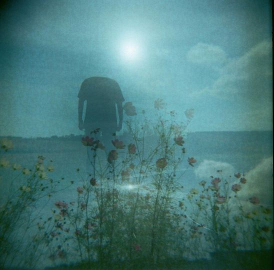
Neil A White is an English-born photographer and teacher currently living in London. Growing up in the north of England, Neil would escape to the countryside whenever he could. This fascination with the natural world and contrasting environments is at the heart of his photography and an infinite source of inspiration. His work explores the relationship between nature and the modern world, and how they co-exist, sometimes harmoniously, more often in conflict with one another. He sees this conflict as one of the key dilemmas of modern day existence. When taking pictures of landscapes, he tries to connect with the land, feel the air, the light and bring those feelings into his photographs. He received and MA in Photojournalism and Documentary Photography in 2006 from the University of the Arts in London, adding to his BSc in Engineering Management. Work from his Lost Villages series has been published in The Guardian Magazine and Geographical Magazine and was highly commended in The Environmental Photographer of the Year competition in 2011.
Lost Villages
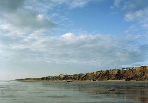
The Holderness coast located in the North East of England endures the highest rate of coastal erosion in Europe. The devastating consequence of this is villages and land slowly disappearing into the sea. The Lost Villages project aims to explore the constant battle between the North Sea and the mainland, and to document the irreversible change taking place on the Holderness coast.
The speed of the erosion has increased significantly in the past decade thanks to rising sea levels, which is linked to climate change. It is estimated that up 32 villages dating back to the Roman times have already been lost to the sea. During World War II many outposts were built on this 61 km stretch of coastline. What remains of these outposts is now falling into the sea.
The historical events which took place on this coastline are fascinating. Since Roman times it is estimated that a strip of land three and a half miles wide has been washed into the North Sea. Two miles are estimated to have been lost since the Norman invasion in 1066 AD
One lost village, Ravenser Odd, is particularly significant. Described as a mediaeval “new town” founded in 1235, it was also a thriving sea port. By 1346 it was recorded that two thirds of the town and its buildings had been lost to the sea due to erosion. In the years that followed from about 1349 to 1360, the sea had completely destroyed Ravensor Odd.
Today the village experiencing the severest threat is Skipsea. With a population of around 600, many homes there are set to disappear completely in the next five years. The average annual rate of erosion is around two metres of land per year, or two million tonnes of material. Most of the land here is covered by glacial till, a soft boulder clay deposited over 18,000 years ago.
The Lost Villages project will continue to document the erosion of the Holderness coastline and the difficulties experienced by the people, who are quite literally living on the edge there. In just over a year of working on this project, I have seen the coastline change markedly right before my eyes. This really does bring the speed of the erosion into reality.