In early October 2013, the IPCC (Intergouvernemental Panel on Climate Change) experts presented their 5th report on climate change.
Nowadays, the link between human activty and the increase in the average global temperatures appears to be beyond dispute. The increase in the sea level and the multiplication of extreme phenomena (typhoons, tornadoes, cyclones and foods) are among the main consequences of this mechanism.
In its previous report from 2007, the IPCC foresaw an increase in the average rising sea levels between 18 and 59 cm and so by 2100. But today, the panel is much more alarmist and according to the most unfavourable calculation hypothesis, it puts forward the fgure of 98 cm.
This prospect would have a devastating impact on various places all around the world. Countries and regions which land is less than 5 cm higher than sea level are in the front line.
In 2011, the World Bank established a list of the 12 most-at-risk countries facing climate change. Located to the north of the Bay of Bengal and almost surrounded by India, Bangladesh is on this list. It shares a thin eastern frontier with the sovereign state of Myanmar. The southwestern part of the country is occupied by the Ganges Delta which is the world’s largest one.
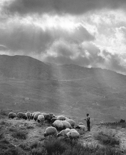
This part of the Ganges Delta is one of the most disaster-prone region of Bangladesh. It suffers directly from rising waters, extremely violent Monsoons, collapses of banks and dams, foodings, soil salinization, but also from an increase in the number of cyclones.
Chalna is the last reachable village by bus of Dacope Upazila region. Surrounded by the Pashur river and by countless smaller ones, this area is the closest to the Indian Ocean. 50 km further south is the Sundarbans national park dying away in the Bay of Bengal.
These rural areas are characterized by a particularly precarious balance and by small-scale means. Dams, crossing over the region are not only used as bulwarks against the river violent spates, they are also used as roads. Motorbykes are the only motor vehicles than can run on
them.
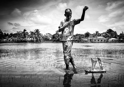
The literary rate does not exceed 40%. Most of the inhabitants either work in rice felds, look after cattles or run crafts’ shops. Chalna is the main village of the region but there is only one internet station which is in the village newspaper offce.
In such a context, the population cannot be properly informed about the rising water phenomenon. The notion of global scale is totally unknown to them and the few people who decided to leave this area went to Khulna- the 3rd largest city of Bangladesh, situated 50 km away from there.
According to the BCAS ( Bangladesh Centre for Advanced Studies) panel, 17% of the land will disappear by 2050. Local populations whose ecological footprint is close to zero will be the frst victims of this worldwide mechanism.
This article is reserved for subscribed members only. If you are already a member, you can log in here below.
Subscribe for full access to The Eye of Photography archives!
That’s thousands of images and articles, documenting the history of the medium of photography and its evolution during the last decade, through a unique daily journal. Explore how photography, as an art and as a social phenomenon, continue to define our experience of the world. Two offers are available.
Subscribe either monthly for 8 euros (€) or annually for 79 euros (€) (2 months offered).